
Arizona Storm Damage
|
If a tornado rips down hundreds of trees in the forest, but there is nobody there to hear it, does it make a sound?
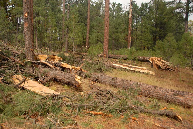
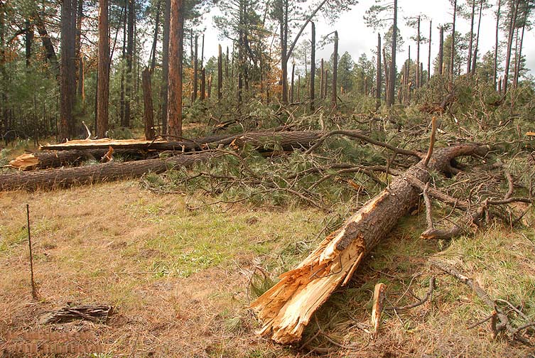
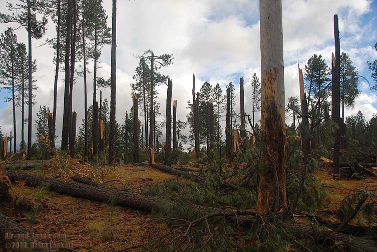
As I was exploring forest roads above the Mogollon Rim on Thursday, October 21, I found an area where many of the trees had been broken off or knocked over.
 The trees had not been cut down. They were snapped off.
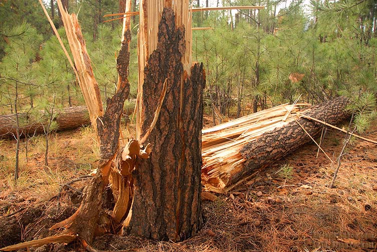
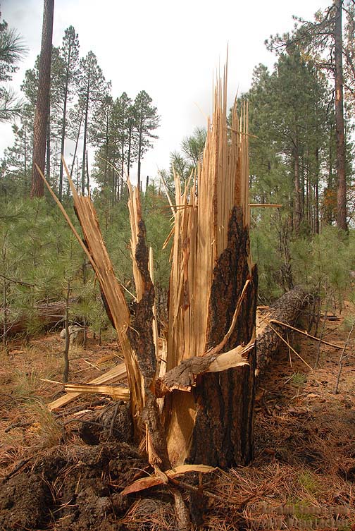
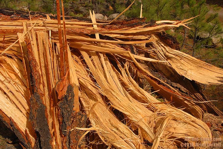
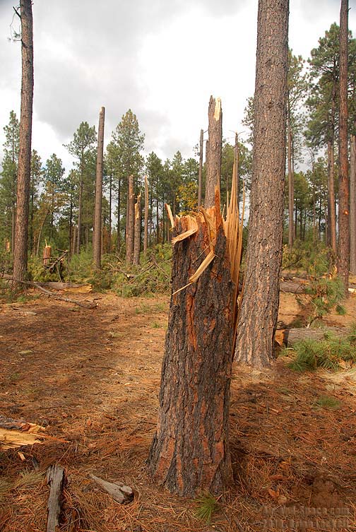
 Something very powerful had splintered the wood of the trees.
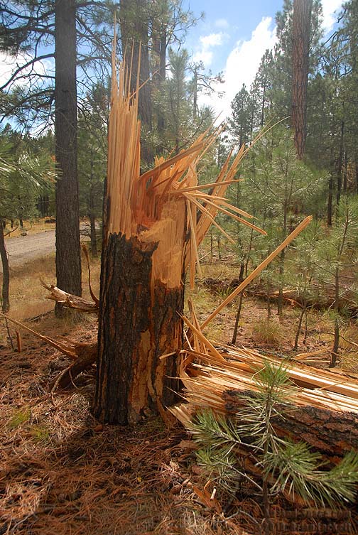
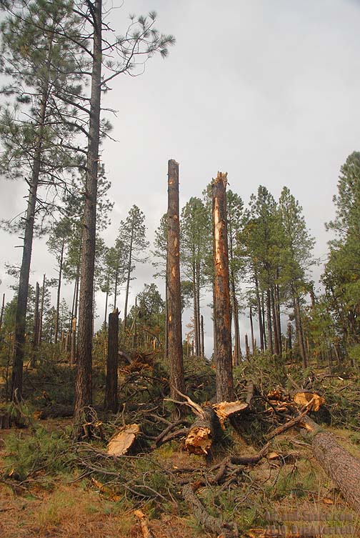
 Some of the trees had snapped off a few dozen feet above the ground.
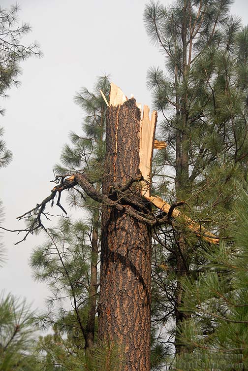
 The wood was still pliable and the needles were green and fresh. Not far away, other trees were undamaged.
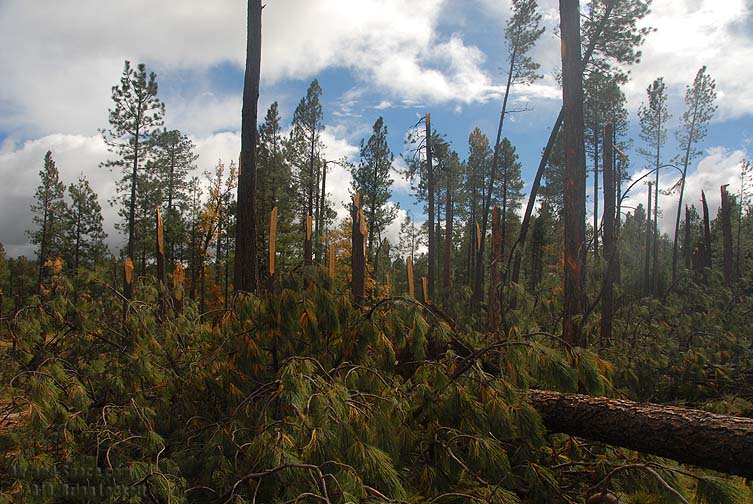
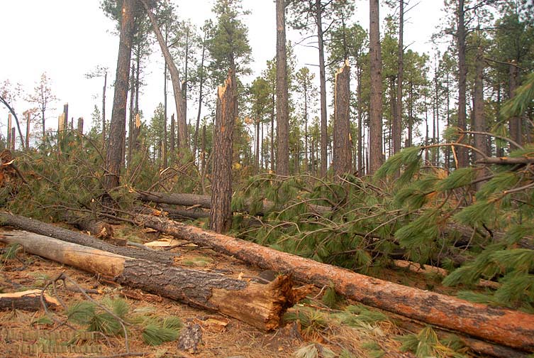
 In places, the ground was covered in tree turnks and branches.
 Fifteen days earlier a very powerful storm had spawned a number of tornadoes across Arizona. This was where one of those tornadoes had touched down. It left a string of holes in the forest canopy across nearly twenty mniles.
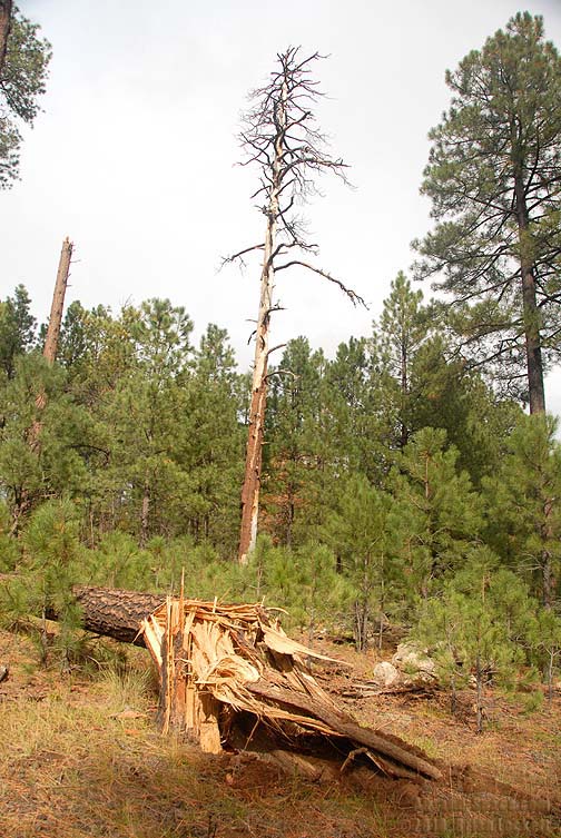 The damage from the tornado has a sharp edge. Just a short distance from destroyed trees a large dead snag stands undamaged.
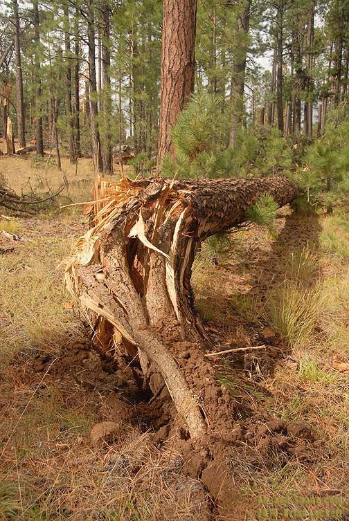
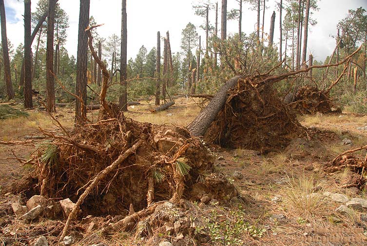
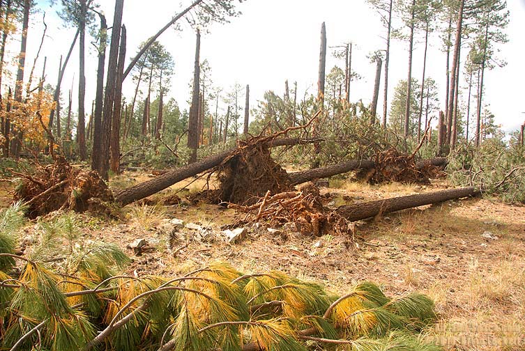 Some of the trees fell over, pulling their root balls out of the ground.
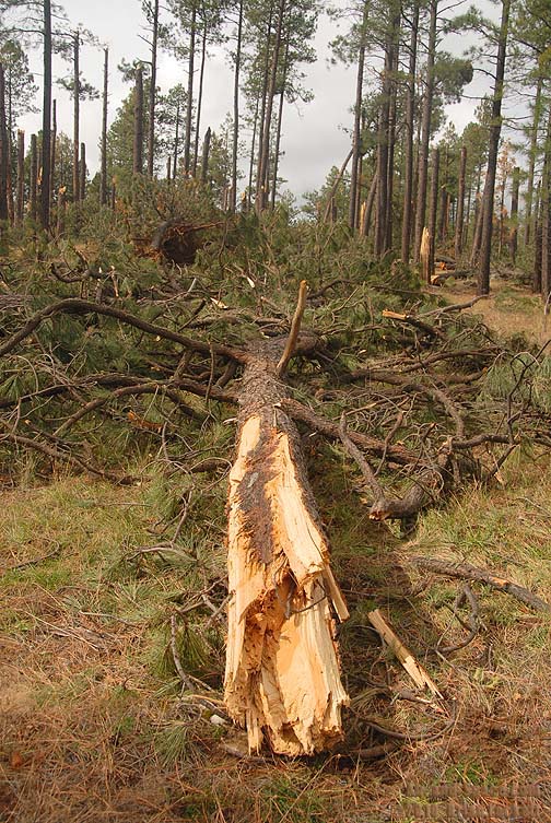
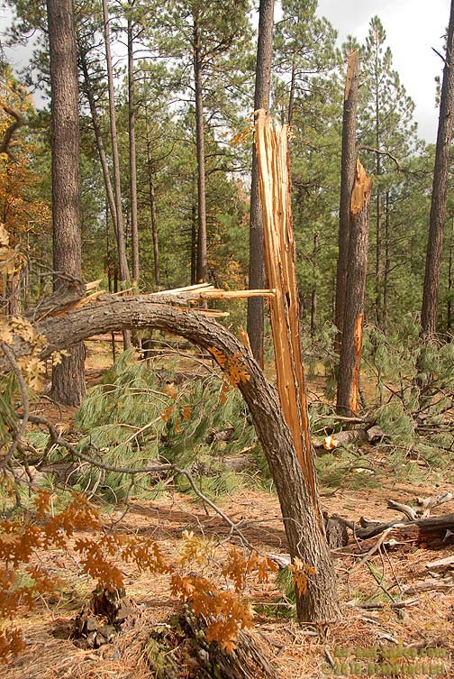 Many of the trees snapped part way through and then peeled away down the trunk.
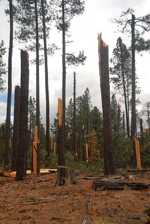
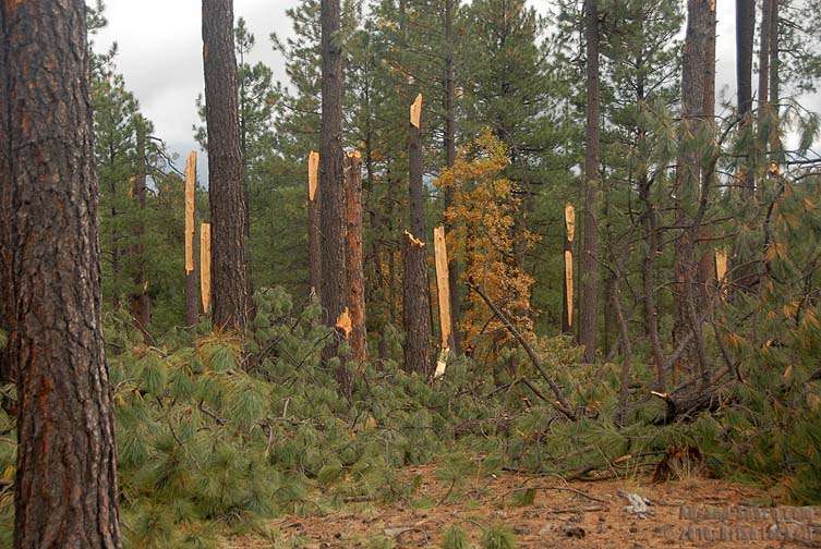
 The wind stripped the bark from some trunks.
 This tree knocked a large boulder down the slope. There was almost no storm damage on the far side of the road. The road passed through another extensive area with fallen trees about a mile away.
I returned to the Coconino Forest above the Mogollon Rim on Thursday, November 4 to photograph more of the tornado damage.